About
A live map of the sky, in three dimensions
Alārium shows aircraft moving as they actually move: at their real altitude, on their real track, right now, wherever the world’s community receivers can hear them. It is free, and the map needs no account.
- Fields tracked
- 5,019
- Airfields with a page
- 25,249
- Drawn position, measured
- 30 m
- Receiver networks read
- 3
01 · Looking
What you are looking at
Every aircraft is drawn where it is in the air, carried smoothly between the reports it broadcasts.
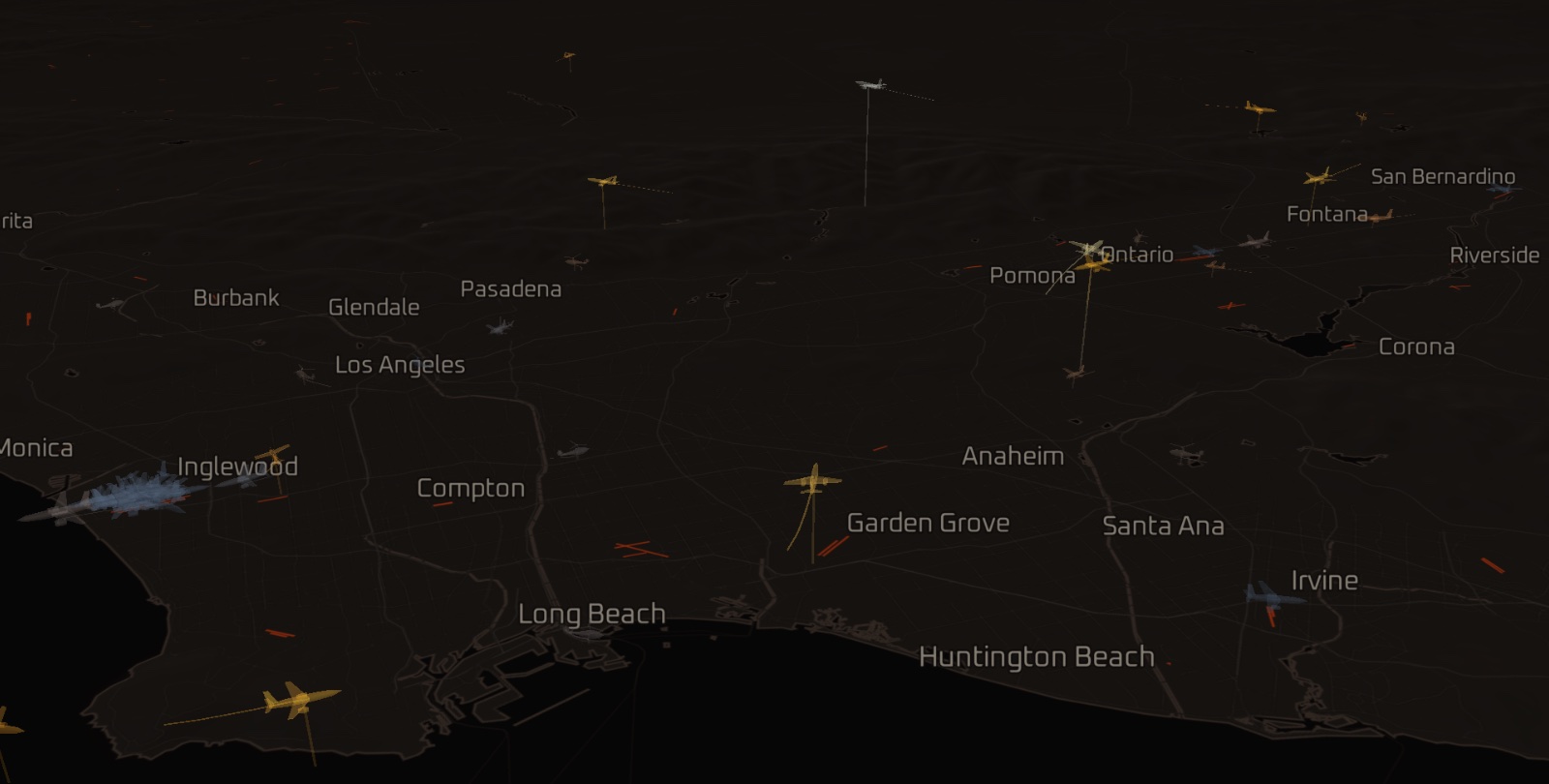
Every aircraft on the map is broadcasting its own position, altitude and speed over ADS-B, and somebody on the ground nearby is listening with a small receiver and sharing what they hear. Alārium reads three of those shared networks, once a second, and draws the result.
- Model
- airliner
- Triangles
- 1162
- Bank
- from turn rate
- Pitch
- from vertical rate
- Attitude glide
- 1.2 s
Most trackers put altitude in a panel as a number. Here it is a place. An aircraft is drawn where it is in the air, with a line down to the ground beneath it, so a climb-out, a descent and a holding stack look like what they are. Plan view is the working surface; the three-dimensional camera is a mode you switch on when one approach corridor matters more than the whole region.
- Reports
- 4 – 15 s apart
- Drawn vs reported
- p95 30 m
- Threshold
- 120 m
Reports arrive sparse and out of order. Between them each aircraft is carried forward on its own heading and speed rather than jumped, so motion reads as flight. Measured end to end, the drawn position sits within about thirty metres of the reported one.
02 · Reach
Where it looks
The whole globe between 60° south and 72° north, watched where people are looking.
- Band
- 60°S – 72°N
- Cell
- 250 nm
- Budget
- ~1.8 req/s
- Warm
- 10 metros
- Spare
- 8 hubs
Coverage is strongest where receivers are dense: North America, Europe, Japan and Korea, coastal Australia, the Gulf, Brazil. It thins across much of Africa, Russia and Central Asia, and there is nothing over open ocean, where only satellites can hear an aircraft and nobody shares those for free.
The networks allow roughly two requests a second in total, so the map cannot watch the whole planet at once. It watches where people are looking. Pan somewhere new and that patch of sky wakes within a few seconds; the count in the corner says waking until it has. Ten North American hubs stay warm around the clock, and a handful of hubs abroad take whatever capacity is left over, in their own daytime.
That has a consequence worth stating plainly. Where a field is only watched part of the time, its movement totals cover only that part, and the panel says so under the number: watched 41%. A count without that line was counted throughout.
03 · Finding
Finding something
Search takes whatever you have. Filters narrow the sky. Follow holds the camera on one aircraft.
- Callsign
- UAL 315
- Tail number
- N506AS
- Transponder
- a6504b
- Airport
- KLAX · LAX
- City
- Tokyo
Filters narrow the sky by status, category, altitude band, climb or descent, and operator, and any combination can be saved as a named view once you have an account.
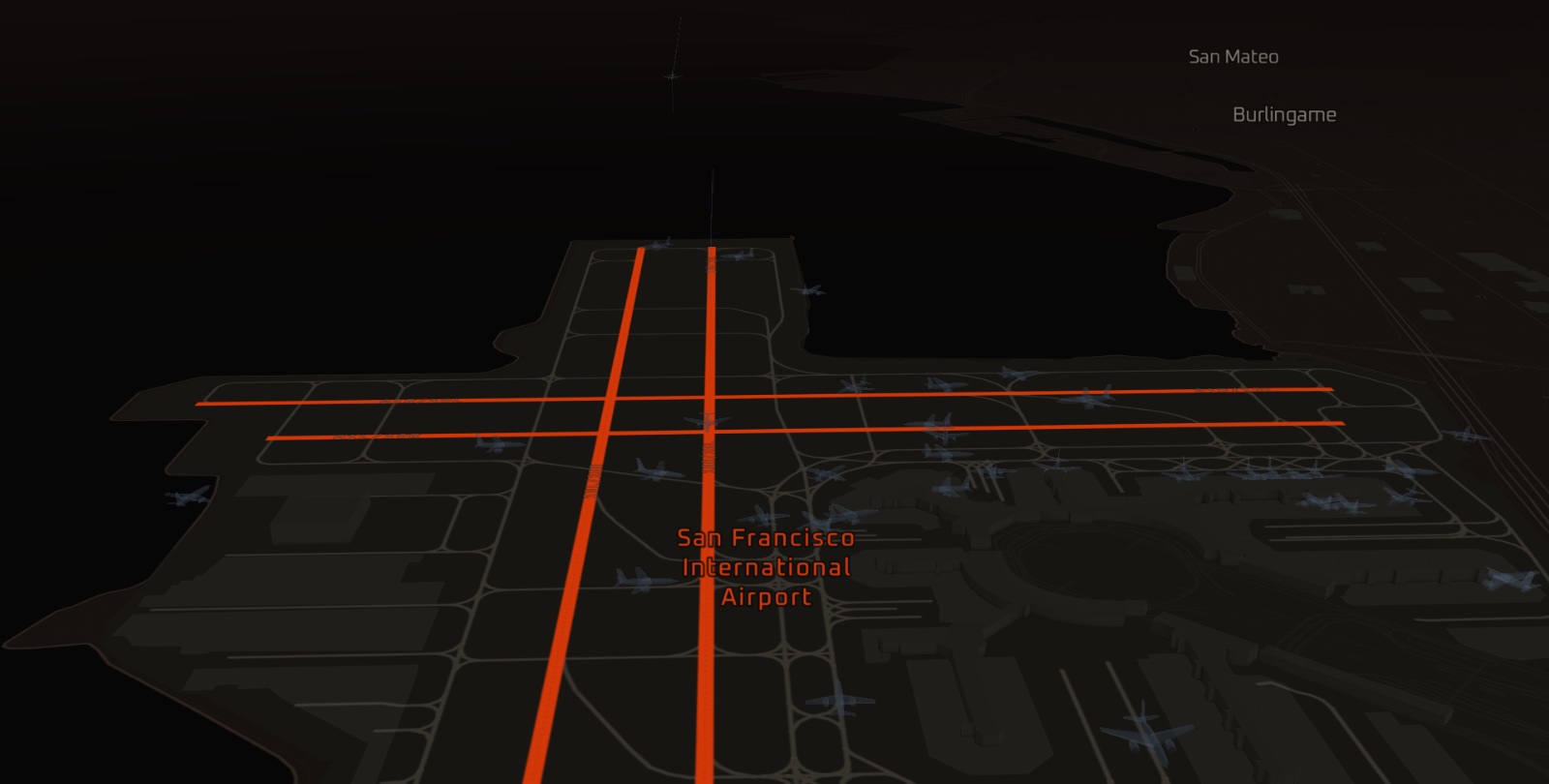
Select an aircraft and the panel opens beside it. Follow it and the camera holds it centred while it climbs out, and the stream keeps sending it even when it outruns the screen.
04 · Knowing
What the panel knows about a flight
Observed before filed. A confident wrong answer is worse than none, so a contradicted filing is withheld.
- Filed
- KDCA → KBNA
- Observed
- 263° over the Pacific
- Off the leg by
- 1,931 nm
- Verdict
- withheld
About half the traffic flies under a tail number rather than an airline callsign, and no route database holds a flight plan for those. So Alārium watches instead: an aircraft low over a field, climbing hard, has just departed it. Nobody filed that. It was observed, and it works the same for a Cessna as for a 737.
Where a filed route exists it is checked against the live track before being shown. Roughly three filings in five describe a leg the aircraft is not flying, because callsigns are reused, so a filing the aircraft’s own position contradicts is withheld. Where there is no filing, the destination can sometimes be read from the descent, and the panel says which of the two it is looking at.
A US flight number also carries a history. Department of Transportation on-time data says what that number usually does: when it tends to land, and how often it was on time. That is a record of past months, not today’s schedule, and it is labelled as one. Alongside all of it: altitude, speed, vertical rate and attitude as the transponder reports them, the observed profile drawn as a chart, the registration’s country, and a photograph of the airframe where one exists.
05 · Fields
Airports
25,249 airfields have a page. The 5,019 the map tracks carry conditions, movements and notices.
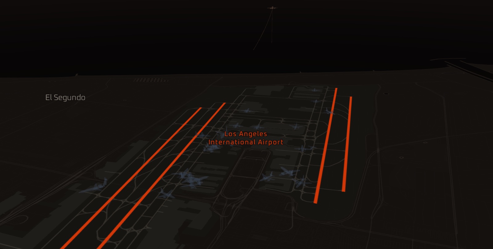
Every page carries the field’s runways drawn to their true orientation, its elevation, its local time and its nearest neighbours, from the largest hubs to single grass strips, in every country the data reaches.
The fields the map itself tracks get more. Current conditions from the field’s own METAR wherever one is reported, including density altitude and the runway the wind favours, which are the two figures pilots reach for and most weather sources leave out. A photograph of the airport where Wikipedia has one with a credit. The arrivals and departures Alārium has observed there today, over the last week and over the last month. And for United States fields, the FAA’s own notices: ground stops, delay programmes and closures, each with the reason the FAA gave.
Los Angeles, London Heathrow, Tokyo Haneda and Sydney are good places to start, or browse every field.
06 · Landing
Being told when a flight lands
By email or on your device, from any aircraft on the map or a flight number. It reports what was seen.
- Seen
- on the surface
- From the field
- 0.9 nm
- Reported as
- Landed
- Not claimed
- the gate
With an account, Alārium will tell you when a flight lands. Set it from any aircraft on the map, or by typing a flight number and its destination, which works before the aeroplane has pushed back. Where a live status source knows which airframe is flying that number today, the watch follows the aircraft itself rather than the callsign. Signing in is an email address and a six-digit code. There is no password and nothing to pay.
An alert reports what was observed: a transponder on the ground within four miles of the field. That is the aircraft, not the gate, and the wording never widens past it. Coverage is finite, so each watch says plainly whether it is being held, is running on best effort, or was not seen, and when the limit is ours it says so and points you to the airline.
07 · Limits
What it cannot see
Alārium runs on volunteers’ receivers. Being straight about the limits is what makes the rest of the numbers mean anything.
- No transponder, no aircraft
- An aircraft with no ADS-B transponder does not appear. Some traffic arrives by other paths, including radar-derived TIS-B and a little multilateration, and each aircraft’s panel says which. Those positions are coarser and slower to update, and they are labelled as what they are.
- Oceans and thin regions
- Nothing over the oceans, and little over regions with few receivers. The count in the corner says not watched where the map cannot look at all, and an empty patch of sky is an honest answer rather than a fault.
- Observed, not complete
- Movement counts are what Alārium observed, never a complete record. Each total names the window it covers and, where the field was watched only part of the time, how much of it. Departures and arrivals are counted under different rules, so fields are ranked against each other rather than balanced.
- Barometric altitude
- Altitude is barometric, as broadcast. Near the ground on a high-pressure day it can read below the airfield itself.
- FAA status is US-only, and about airports
- It describes an airport, never a flight. Every field elsewhere is outside what that feed can speak about. Silence there means Alārium has nothing to say, not that there are no delays.
- Flight history is US domestic
- A British Airways or Qantas number has none, and the form simply asks you for the destination and time instead.
- A photograph is of the tail, not the flight
- Often taken years earlier and sometimes in a previous operator’s paint. Roughly a quarter of aircraft have none and keep the drawn schematic.
Sources
Where the data comes from
Named, so a reader knows whose word each figure rests on.
- Positions
- ADS-B, ADS-R, TIS-B and MLAT, aggregated by adsb.fi, adsb.lol (ODbL) and airplanes.live, from receivers run by volunteers
- Weather
- US National Weather Service aviation METAR, worldwide
- Airport status
- FAA National Airspace System status, United States
- Airfields
- OurAirports
- Airlines
- VRS standing data
- Flight history
- US Department of Transportation on-time performance
- Live flight status
- AeroDataBox
- Aircraft photographs
- Planespotters, Airport-Data
- Airport photographs
- Wikipedia, Wikidata, Wikimedia Commons
- Basemap
- Mapbox, OpenStreetMap
Alārium is an independent project, not affiliated with any aviation authority, airline or air navigation service provider. It is for interest and education. Do not use it for any operational, navigational or safety purpose.
Colophon
Who built this
Alārium is designed and built by Brandon Ponce, a product designer. The interface, the rendering, the service that reads the feeds and shares them with every open browser, the airfield and weather data, and the writing. More work at poncedesign.info and on LinkedIn.
Found something wrong, or want to know how a piece of it works? Get in touch.